Where Sydney Began - The Tank Stream - June 2026
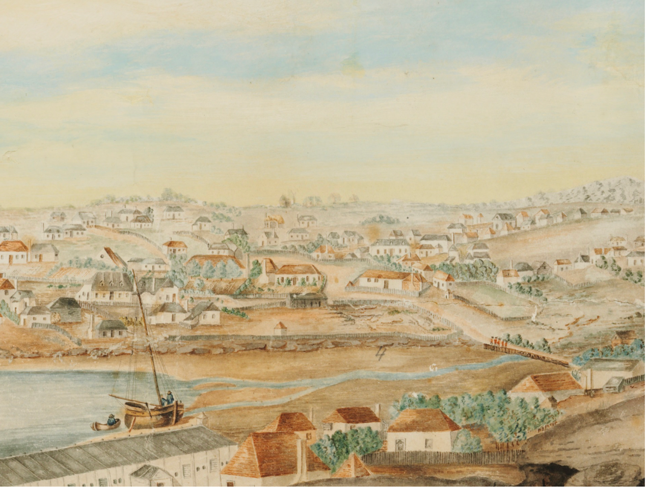
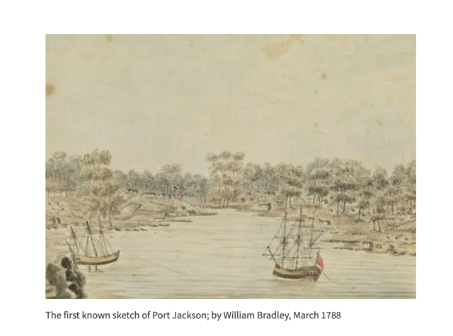
(top photo: Sydney from the west side of the Cove, c1802, by George William Evans), State Library Collection. Other photos are sourced below
I’ve become a little obsessed with the Tank Stream! Why? I think it’s because the Tank Stream is the reason Sydney exists where it does today — and because I keep discovering traces and references to it around the city - if you know where to look.
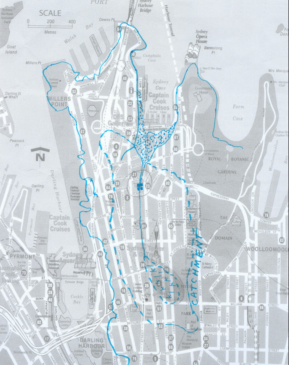
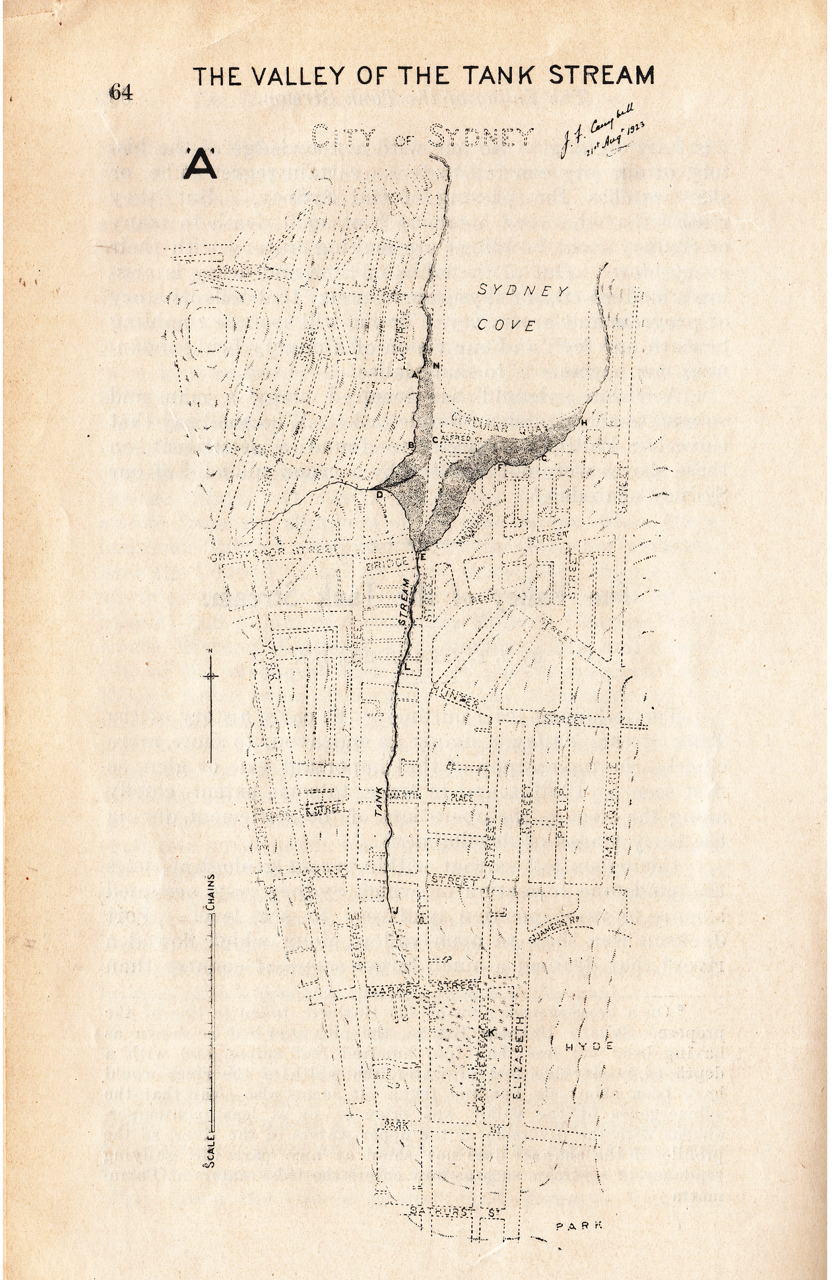
In 1788, Governor Arthur Phillip chose Sydney Cove over Botany Bay because of its deep water anchorage and reliable fresh water, set within a natural landscape of forests and valleys. The Tank Stream’s source was a spring near the upper corner of Hyde Park, around today’s College, Oxford and Liverpool Streets. It flowed about 2 kilometres to Sydney Cove.
At the time of the British invasion in 1788, between 4,000 - 8,000 Gadigal lived across the Sydney region, in a landscape rich with mangroves, grasslands, forests, plants and animals. For the Gadigal, the stream was part of a wetland, a food source and a fresh water supply, used and cared for over countless generations. Within months, land was cleared, streams were polluted and Aboriginal people were displaced. (https://200george.mirvac.com/workplace/building-overview/public-art)
From Hyde Park, the stream dropped almost 30 metres through a series of small waterfalls before reaching the harbour. It was fed by springs near today’s King and Spring Streets. Remarkably, it was once tidal and deep enough for small schooners to reach Bridge Street (at high tide), which was about 3+ metres above sea level. Bridge Street, or probably Bridge Lane, was named after the first log bridge, built across the stream in 1802, which you can see above in a painting of that era - the one attributed to George Evans. https://www.sydneybarani.com.au/sites/the-tank-stream/
It was later replaced by stone bridges. Even today, you can see and feel the dip in the road as you walk up Bridge Street towards either George Street or Macquarie Street. From the very beginning, the stream also divided Sydney’s social world: officials lived on the western side, while convicts and their military guards were housed to the east. Class divides, even then!
The stream was the colony’s lifeline. It supplied drinking water for people and livestock and, for a while, was carefully protected. Phillip declared what is often considered Australia’s first environmental protection order: a 15-metre buffer on each side of the stream, where grazing, tree cutting and polluting activities were forbidden. Governor Hunter continued in this vein. Bravo to them! Of course, the Gadigal had long understood its preciousness and the importance of keeping the stream clean.
When Governor Phillip arrived, it had been a very wet summer. However, in 1789 a severe drought struck and the stream almost dried up. To improve the water supply, Phillip instructed convicts to cut 3 storage tanks into the sandstone banks near the intersection of present-day Bond and Pitt Streets. Each tank held nearly 20,000 litres of water. These tanks gave the stream its enduring name. Sadly, no one knows the stream’s original name — a great pity.
The word tank probably comes from the Sanskrit taḍāga, meaning an artificial pond or lake. It was likely introduced to Sydney by British officers familiar with Indian water-storage systems, who supervised the construction of the tanks. Excavations around the Tank Stream have also uncovered Aboriginal flaked stone artefacts made from water-worn pebbles.
Over time, however, care gave way to convenience and poor decisions. Houses and pigsties crept into the protected zone, pollution increased, and illness followed. By 1828, the water was so contaminated it could no longer be used for drinking or bathing, and the stream was diverted into a sewer. In the 1840s, the Tank Stream was channelled underground, and the area beyond the bridge was reclaimed and remodelled as part of the later construction of Circular Quay.
A sandstone arch was placed over the stream in 1860 to help control the polluted waterway running through the middle of town. A great improvement, health-wise! The Bennelong Point Sewerage System, built in 1857, was Sydney’s first planned wastewater and sewage network, and significantly improved public health. By the 1870s, the Tank Stream was completely covered. An oviform structure was later built to support large buildings and manage stormwater.
Yet the Tank Stream never disappeared. It still flows beneath the city, contained but not erased, in a covered stormwater drain.
The Tank Stream reminds me that cities are built on fragile foundations. History is not something neatly contained in museums or plaques. The stream still runs quietly beneath us, shaping our present whether we acknowledge it or not. Water, once ignored or abused, does not forget, as Sydney can attest.
Above ground, there are still many quiet visual reminders of the Tank Stream, which you can see here:
o Circular Quay information boards
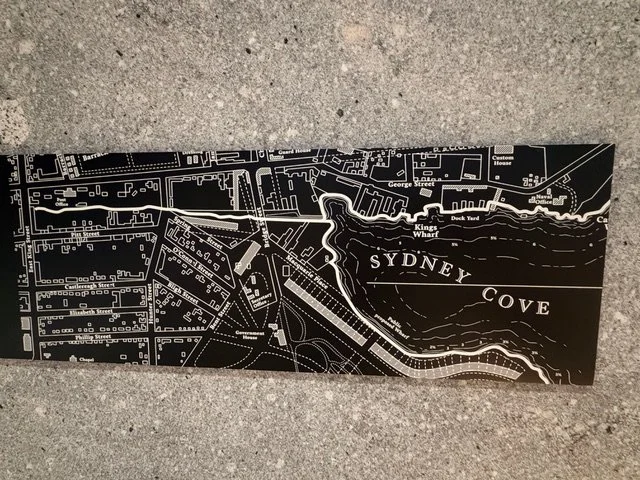
Sydney Water’s excellent temporary information boards at Circular Quay tell the Tank Stream story under the apt heading: Sydney’s story begins with water. Look for the raised 1988 map of Sydney Cove with the Tank Stream overlaid. Impressive!
o 1788 shoreline markers
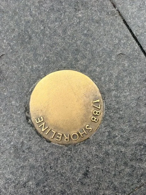
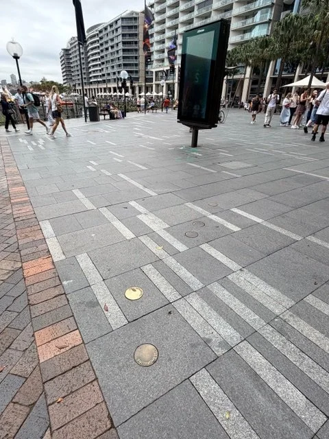
On the eastern side of Circular Quay, look for the cast bronze discs embedded in the paving. These mark where the water met the land in 1788. Fascinating!
o Tank Stream Fountain
Near Circular Quay, find Stephen Walker’s four-part Tank Stream Fountain, erected in 1981 to mark the Sydney Morning Herald’s 150th anniversary. Also called the Children’s Fountain, it is dedicated to the children who once played around the Tank Stream.
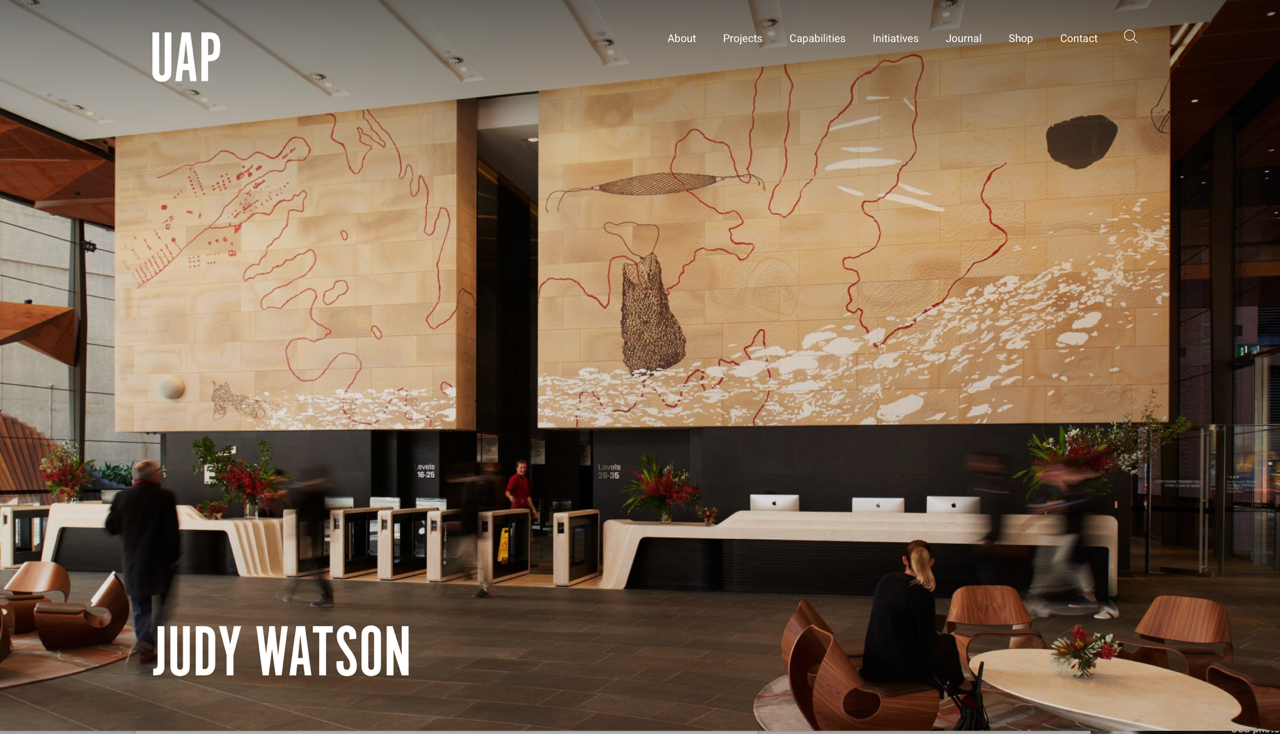
o Judy Watson’s mural, EY Centre, 200 George Street
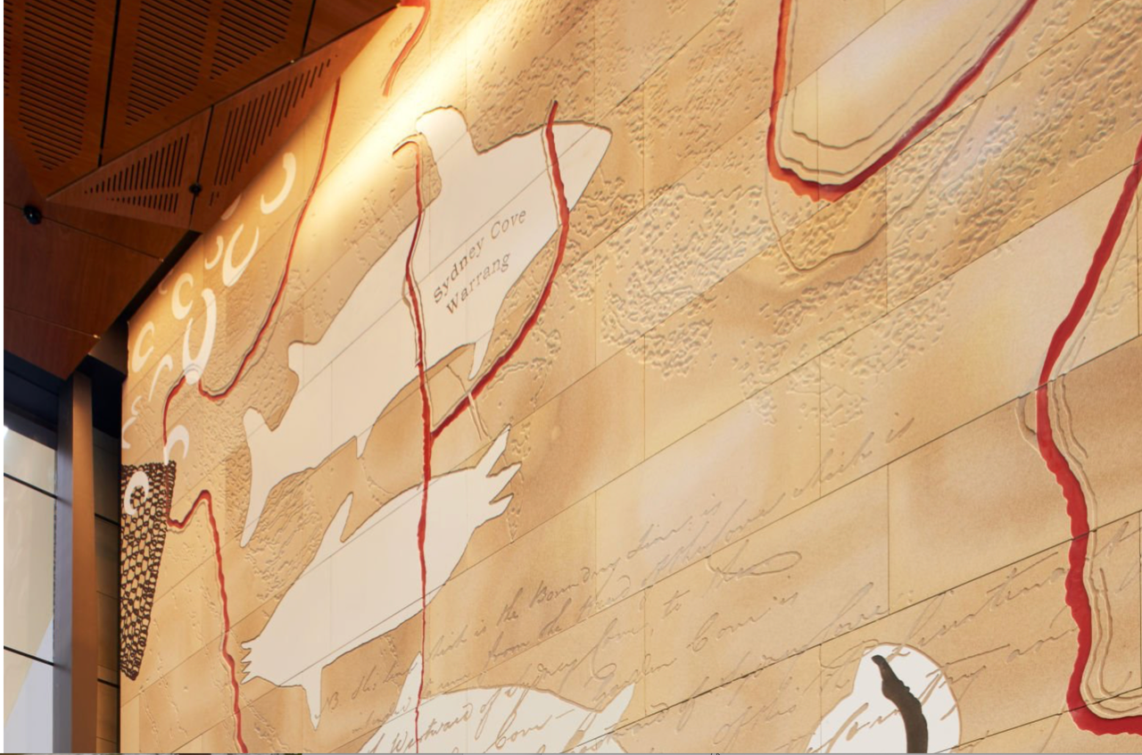
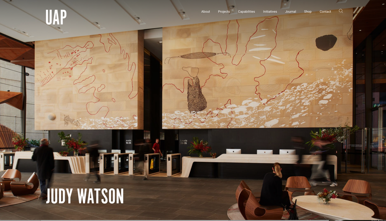
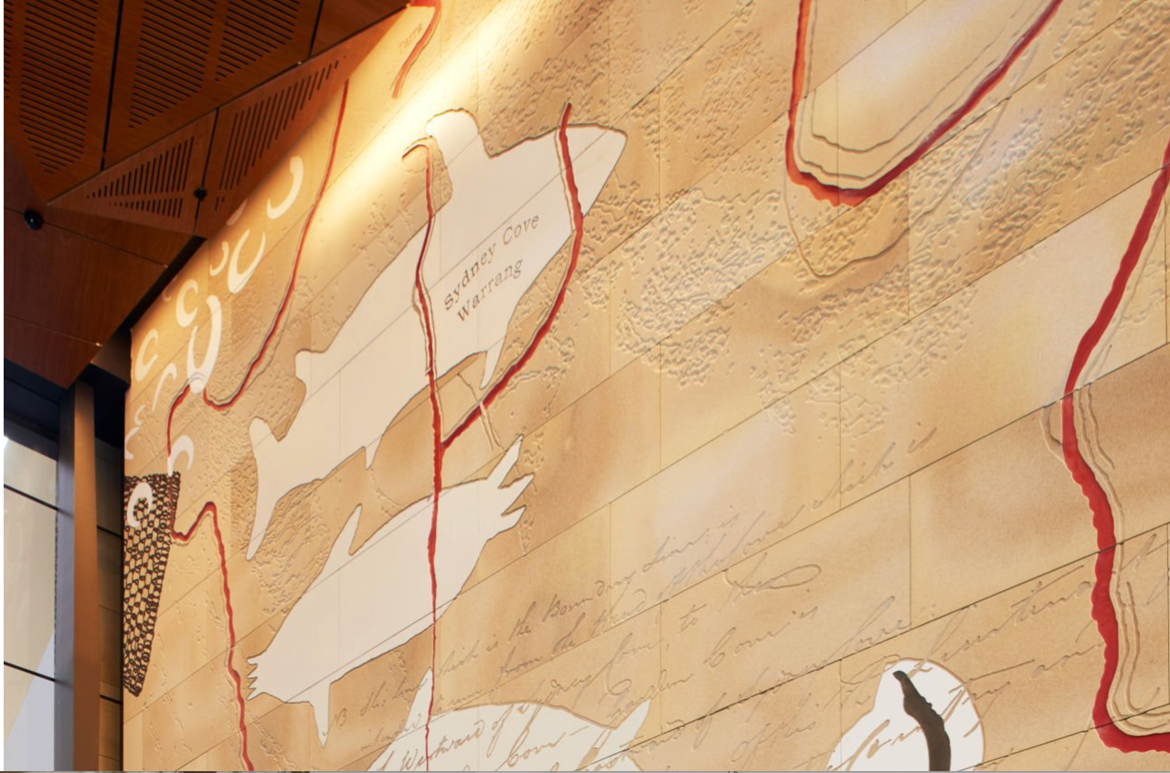
View Judy Watson’s wonderful sandstone interpretative mural, NGARUNGA NANGAMA: Calm Water Dream. The site connects directly with the Tank Stream, which runs parallel with George and Pitt Streets. Watson draws on early images of the stream and Warrane/Sydney, layering water, maps, memory and Country across the stream’s original path.
o Bronze shoreline inlays near EY
To the right of the EY foyer, look for the long bronze inlays marking the original shoreline of Sydney Cove in 1792. They include early descriptions by Watkin Tench and Governor Phillip, including: ‘Into the head of the cove … runs a little stream of fresh water.’
o Underwood Ark in Underwood Street
Walk down the steps behind EY into Underwood Street. The murals here tell some of the area’s layered history. Then look up to see Underwood Ark, a huge and striking Blackbutt tree (Eucalyptus pilularis); a public tree sculpture near the Tank Stream’s historic river mouth, a symbol and a reminder of the extensive environmental and social change that has taken place across this country and an acknowledgment of the Gadigal people who once lived here. Underwood Ark calls us to contemplate the magnificence and fragility of nature; it asks us to reflect on our connection to this land and the natural world.
o Bridge Lane, Bridge Street and Tank Stream Way
Walk up Bridge Street to its lowest point, near Tank Stream Way, which marks the stream’s course at street level. Here you are close to the site of the first simple log bridge (in Bridge Lane), built by convicts in 1802, and later replaced by stone bridges. Feel the slope!
o Curtin Place plaque
In Curtin Place, look for the plaque commemorating the Tank Stream. Nearby, storage tanks were cut into the solid rock on both sides of the stream, close to today’s Pitt and Spring Streets. Tank Stream tours once began here.
o 123 Pitt Street,Angel Place, Moss Wall
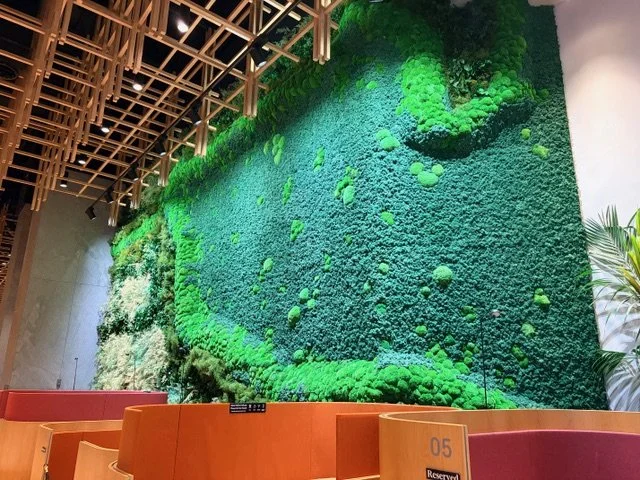
At 123 Pitt Street, see the remarkable Moss Wall, made from real and preserved moss and designed to evoke the topography of the underground Tank Stream, which still flows beneath the area. Wow!
o 123 Pitt Street, Angel Place -Tracey Deep’s Water Spirit
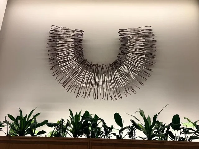
Also here, look at Tracey Deep’s three wall sculptures, Water Spirit which reconnects this site with the Lower Tank Stream Valley and ‘honours the cultural and spiritual significance of water and Country.’
o Lynne Roberts-Goodwin’s Tankstream markers - Angel Place Concert Hall foyer
Lynne Roberts-Goodwin’s 1999 public artwork, Tankstream — Into the Head of the Cove, once traced the stream’s underground path through long, minimal pavement markers. Sadly, most were decommissioned in 2019; one remains in the Angel Place foyer.
o GPO basement museum, 1 Martin Place
Visit the tiny ‘museum’ in the GPO basement to see old maps and paintings of the Tank Stream, along with an example of an ovoid, or egg-shaped, drain.
o Gadigal Metro Station murals
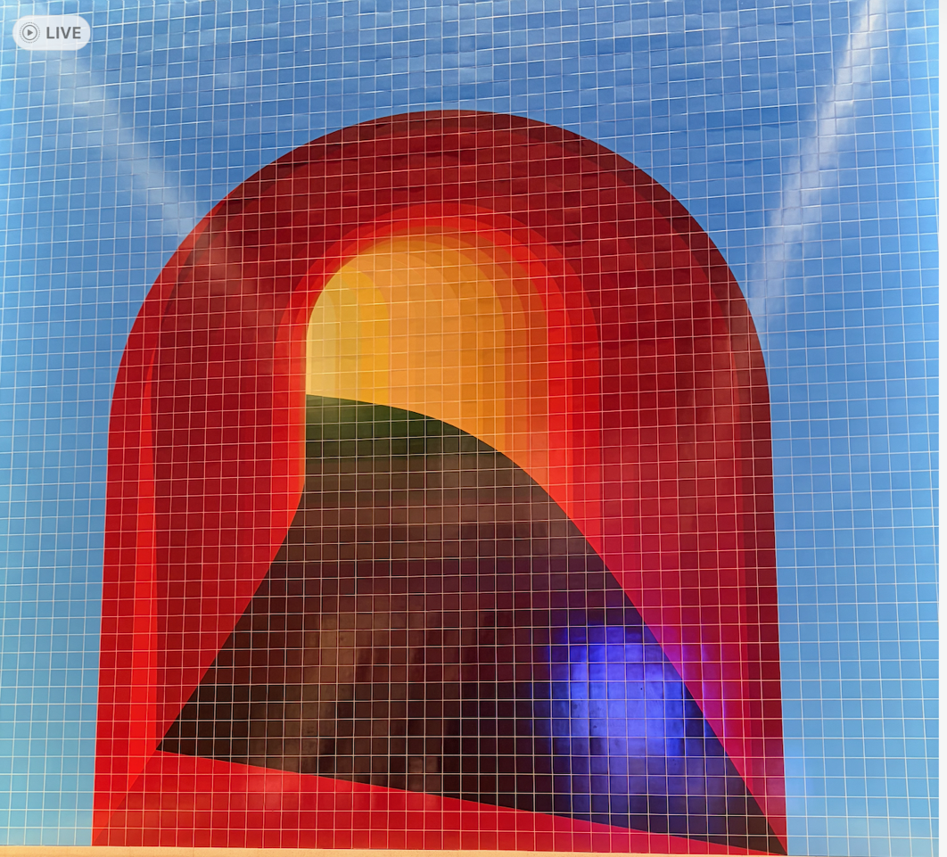
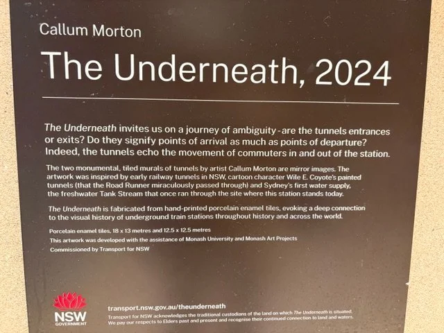
At Gadigal Metro Station, view Callum Morton’s award-winning tiled murals, The Underneath. These brilliant works flank the station exits and depict tunnel portals and the flow of the original Tank Stream. The curves follow the bends of the stream still running beneath the city. Fabulous colours!
o Archibald Fountain, Hyde Park
Near the Archibald Fountain, the Tank Stream began as spring water seeping through sandstone into a small marsh, before trickling west and north down towards Sydney Cove. There is no plaque or reference here - but this is where the story begins.
References and Sources:
https://200george.mirvac.com/workplace/building-overview/public-art
https://mhnsw.au/learning/tank-stream-before-and-after-1788/
https://www.fdcbuilding.com.au/angel-place-is-home-to-australias-largest-moss-wall/
Check out the fabulous book with early maps and drawings: First Views of Australia 1788-1825 by Tim McCormick, 1987, David Ell Press.